A lockdown perambulation around the watershed of the upper Eden valley

Keith Beven
Keith Beven is Emeritus Professor of Hydrology at Lancaster University where he has worked for over 30 years. He has published many academic papers and books on the study and computer modelling of hydrological processes. Since the 1990s he has used mostly 120 film cameras, from 6x6 to 6x17, and more recently Fuji X cameras when travelling light. He has recently produced a second book of images of water called “Panta Rhei – Everything Flows” in support of the charity WaterAid that can be ordered from his website.
Mallerstang is the valley of headwaters of the Cumbrian River Eden and has been the subject of a previous article for On Landscape discussing the Essence of Place1.
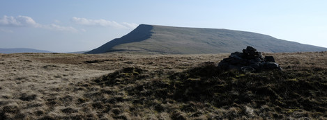
It is a place where I have been fortunate to take photographs for more than 20 years, using both film and digital2. During the spring 2020 lockdown, I had the opportunity to explore some of the more remote parts of the watershed of the Eden, on Mallerstang Edge to the East and Swarth Fell, Wild Board Fell and Little Fell to the West. It is not an area that is very popular with walkers, but during the lockdown, there was no-one to be seen and no aeroplane contrails in the sky.
Mallerstang is now part of an enlarged Yorkshire Dales National Park. Although, of course, it had never been part of Yorkshire. Until the boundary reorganisation of 1974 it was part of Westmorland and then, after that, part of Cumbria. So, there was some strong local protest when, at the new boundary of the National Park in Mallerstang on approaching the village of Nateby, in Cumbria, a sign was erected saying welcome to the Yorkshire Dales. This has now been changed to the Westmorland Dales (with Yorkshire Dales National Park in a much smaller font).


