A Microcosm

Xavier Arnau Bofarull
I am an amateur photographer based on the Taunus Range, a mountain near Frankfurt am Main, Germany. I have no formal training in either art or photography. Since five years I try to improve my skills on Landscape Photography, and as a member of a Photo Club I took part in some Exhibitions.
Water hollows stone,
wind scatters water,
stone stops the wind.
Water, wind, stone.
Wind carves stone,
stone's a cup of water,
water escapes and is wind.
Stone, wind, water.
Octavio Paz1
During the pandemic, it seems that many people – among them photographers - have discovered the nearby landscapes, or as João Ferrão2 wrote, "The pandemic has led everyone to explore the "backyards" of our lives, whether physical or metaphorical."
At the same time, many people are aware of the impact of climate change on our lives and on our planet Earth and try to facilitate both behavioural change and social engagement for the actions needed to reduce gas emissions and our ecological footprint. As a result, a growing number of people – among them photographers - have made the conscious decision to reduce their carbon footprints by avoiding air travel or flying less.
And no need to say that, as a consequence of the high number of existing conflicts and crisis situations in many places around the world with their consequences of enduring violence, struggles among communities and the growth of criminal violence, walking with a camera in some landscapes of the world, could be very dangerous.
The world is at a critical turning point, and travel could be any more – at least in the near future - an illuminating, life-enriching experience, as Joe Cornish wrote in his heartfelt and honest essay3.
This situation gives us the opportunity to be focused on the regional landscapes around where we live, exploring our physical backyards, although that can create new problems, such as restrictions or traffic congestion for visitors accessing the Nature Protected Areas,
My local area
In a broad sense, the regional landscapes I usually explore are the landscapes of the German part of the Rhenish Massif, a massif which stretches from western Germany to Luxembourg and eastern Belgium and is drained centrally by the rivers Rhine and its tributaries Main and Moselle, between others.
The Rhenish Massif was formed approximately between 400 and 290 Ma during a period of large-scale crustal convergence, the collision of continental plates and subduction, known as Variscan orogeny, which there are still witnessed in Portugal, Spain, southwestern Ireland, England (Cornwall, Devon, Pembrokeshire), and in the Czech Republic and southwestern Poland.
These regional landscapes, an almost unbroken belt of forest, look, at first sight, like a featureless and eroded structure of plateaux with smooth, rounded peaks that hardly reach 900 m., cut by rivers and broken by deep narrow valleys.
To Plan or not to Plan, that is the Question
Many discussions and articles take place about that theme, and my conclusion is that it depends on every photographer and on the circumstances of every photographer...at every moment.
Reading topographic maps is my approach to the problem. For me, they are nowadays the best reading of the travel literature genre. I spread the map out on the table, and through the contour lines, I visualise the relief: mountains, valleys, slopes, rivers, lakes, ponds, the depths of the slops, the location of meadows and wetlands... At that very moment, photography becomes geography, and geography becomes photography, both sharing the same problem:
Thus we confront the central problem: any landscape is composed not only of what lies before our eyes but what lies within our heads.4
During these readings, instead of plans, what arise are the ideal landscapes and the ideal photos.
Some years ago, reading a map I saw the sinuous line of a river, on the south border of the Rhenish Massif, the Nahe river, a tributary of the Rhine. Between two meanders of the river the contour lines were drawn close together, very close, showing me that there it was steeper ground. Surely cliffs.
The Red Cliffs
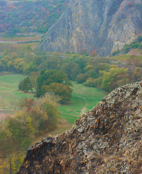
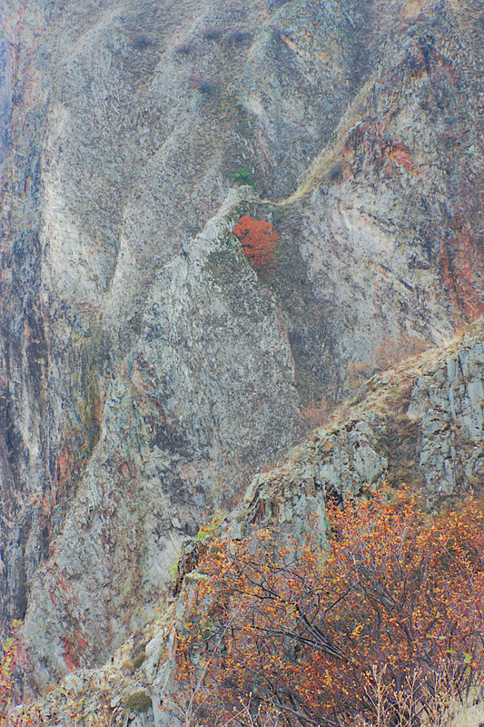
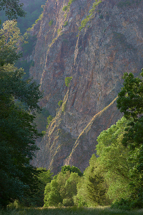
The cliffs between the meanders of the Nahe river are the remains of a Rhyolite massif made up of intrusions and lava flows during a special active volcanic period after the Varizcan orogeny (290 - 260 Ma).
The valleys of the Nahe and its tributaries have been being formed since 2,6 million years ago as a result of the ground heaving of the surrounding mountains of Hunsrück and North Palatine Uplands. This led to strong erosion activities – as Paz wrote: Water hollows stone; Wind carves stone - and depending on the underground, narrow gorges with cliffy precipices arose in areas with hard volcanic rocks -as in the Red Cliffs - or wide gentle valleys with flood plains in areas with soft sedimentary deposits. The frequent change between both forms is charming along the Nahe river.
For four or five years, I've visited and walked around the cliffs - a wall of 1200m. long and 200 m. high – , bounded by a huge number of thermophile species which usually can only be found in the Mediterranean region. Being native to Mediterranean shores, I feel at home.
And every time I visit the cliffs, I remember the Octavio's Paz poem Wind, Water, Stone. The power of the words of the poem fascinated me. With a few verse lines, Paz shows us how the powers of nature sculpt, in an endless and constant play, the surface of our planet.
Doing the same with a few photos instead of words is my dream. But I know that's just a dream. Even with hundreds of photos, I couldn't.
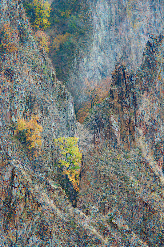
My pictures are the endless attempts to capture the momentary and fragile beauty of these cliffs where some trees survive with an unstable balance over the crests and, in the evening, a pair of common kestrels fly with gentle and slow glides among the crags.
References
- Octavio Paz. The Collected Poems of Octavio Paz, 1957-1987. Printed by permission of New Directions Publishing Corporation.
- Sanatorium. On Landscape Issue 246. December 2021
- A Question of Responsibility. On Landscape Issue 180. April 2019
- Donald William Meinig. The Interpretation of Ordinary Landscapes: Geographical Essays. New York, 1979

