An Alpine river in the 21st century

Mark Robertz
His attention is focused on the landscape in its many forms. His focus is on the photographic realization of landscapes as they are formed by nature and shaped by human use and culture. He also likes to perceive landscape as a resonating space for his own soul. In the same way that he sees landscape as a work of art. He regularly passes on his knowledge to interested parties in workshops and on photo trips/excursions and as an author. He is a member of the BBK - Professional Association of Visual Artists.
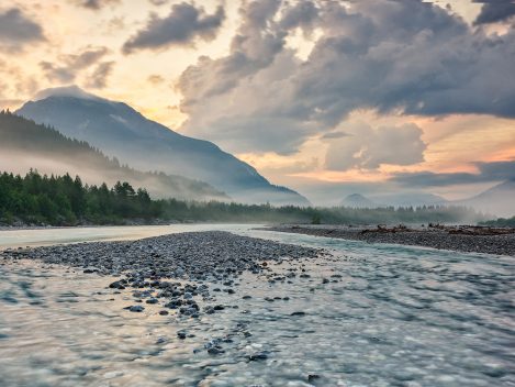
The wild, pristine river in the Tyrolean Lech Valley between Weißenbach and Forchach shows its wild side. It clears the gravel banks exactly as it needs them, piles up dead wood on dry gravel banks and shapes strips of riverbank as it sees fit. Here at the Johannesbrücke bridge, the alpine wild river has been given space to develop freely again, as it did in earlier times. This also has an effect on the habitat along the banks.
"Iller, Lech, Isar, Inn flow to the right towards the Danube." Not only a tried and tested mnemonic, it also tells us the origin of the rivers just quoted. With the exception of the Inn, the first three have their source in the Northern Limestone Alps, between Lake Constance and Lake Königssee.
The special feature of the Lech can be quickly recognized here: Firstly, it has its source much closer to the main Alpine ridge than the Iller and Isar. And unlike the Isar, it flows almost vertically to the north, towards the Franconian Jura, while the Isar drifts eastwards towards the Bavarian Forest.
Similar to the Iller, Isar and Inn valleys, the Lechtal also took on its present form during the last ice age, the Würm Ice Age (comparable to Devensian, approx. 115,000 - 10,000 years before our era). Characteristic features include the steeply rising hanging valleys from which the tributaries flow to the left and right of the river in the alpine 'Oberes Lechtal'. Moraine landscapes with their typical ground forms such as drumlins, dead ice holes or ridges characterize the 'Middle Lechtal'. There are also traces of former ice reservoirs that formed on the edge of the Alps at the end of the Ice Age, which can be seen today in the Füssen Bay. The 'Lower Lechtal', originally characterized by wide gravel plains and broad alluvial forests through which the river meandered on its way to the estuary delta. The appearance of the gravel meadows and alluvial forests never lasted long, the dynamics and creative power of the river were too great. The floods that occurred in spring and early summer at the latest, caused by melting snow and thunderstorms, reshaped the countless water arms that carved their way through the valley.
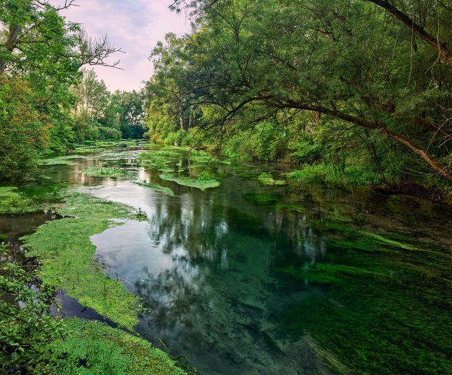
River kilometer 17 | A touch of wilderness can be found parallel to the Lech at the hamlet of Ötz (Thierhaupten) along the Vorderer Brunnenwasser (later Münsterer Alte). Here, at dawn, you can get an idea of how lively the floodplains near the river once were.
If you start a journey along the Lech these days, my tip would be to start at the mouth. In my opinion, this best symbolizes the state of the Lech today: from the present to its origins. You start with the state to which the Lech, like many other rivers, was transferred at the beginning of the 20th century and end in the sublime, majestic, Arcadian-looking backdrop of the Zuger Tal valley in the Lechquellengebirge mountains.
The journey takes you from the mouth at Marxheim below the Franconian Jura along the Bavarian Lech, which, constricted and canalized, is more like a dammed river than a flowing water from power station to power station. Occasionally, the river is accompanied by remaining floodplains. In its lower course, the river is also divided into two watercourses for around 20 km: the Lech Canal for consistent power generation and the original riverbed with a residual flow. With its wide gravel banks, between which the residual water meanders, this is reminiscent of the former gravel meadows of the original Lech.
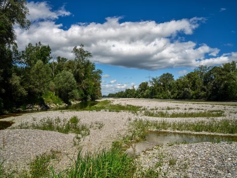
River kilometer 32 | A look at historical maps of the Kingdom of Bavaria north of Augsburg reveals extensive gravel plains with numerous branches of the original Lech. Today's gravel banks, between which the Lech sometimes meanders back and forth, are due to the Lech Canal built at the end of the 19th century. Today, the bulk of the river flows through it, with only a residual amount of water remaining in the actual Lech bed.
Augsburg, the largest city on the Lech, presents itself in the splendor of the UNESCO World Heritage “Augsburg Water Management System” with a proud 22 individual objects in the city area as well as in the surrounding area. Also worth mentioning is the Augsburg city forest (nature reserve, Forest of the Year 2024), which is Bavaria's largest remaining alluvial forest.
If you follow the watercourse further upstream, it is increasingly accompanied by steeply rising valley slopes near Landsberg am Lech. Here, various hiking trails invite you to take extended tours along the river.
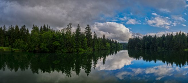
River kilometer 74 | On the Lechfeld at the Hurlacher Heide (between barrages 18 and 19, or Kaufering and Schwabstadl), the Lech encounters rock walls of sintered limestone deposits along a west-facing slope, also known as the “Hurlacher Wasserfälle”. The limestone tuff, which is interspersed with plant and animal fossils, formed here between the Riss and Würm glacial periods. Covered by glacial bed load, erosion gradually brings the rocks formed in this way back to the surface.
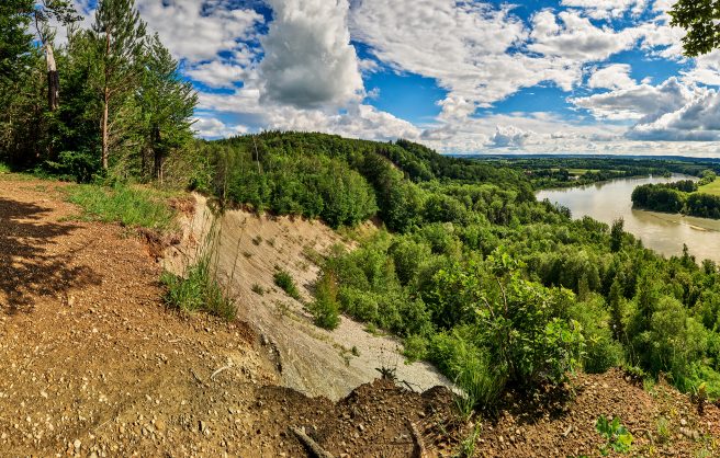
River kilometer 95 | The impact slope northeast of Mundraching shows in a very impressive way the forces that can act here when landslides occur between the upper cover gravels and the underlying layers of the Upper Freshwater Molasse (alpine debris consisting of gravel, sand or fine sediments).
At the height of Schongau, you leave the 'Untere Lechtal' and enter the moraine landscapes followed by the Füssener Bucht in the 'Mittlere Lechtal'. Above the Schongauer See (reservoir!) follows the Litzauer Schleife - a real gem. Here you come across a river landscape that once spread along many of the river bends in the Lechtal. To the left and right of the chain of dams that the Lech still forms here, you can discover traces of the Ice Age in the landscape. For example, the dead ice landscape in the hills around the baroque gem of the Pilgrimage Church of the Scourged Savior on the Wies” (east of Steingaden) or the Drumlinfeld near Prem.
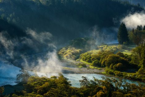
River kilometer 135 | The Litzau loop with its meanders stretches between the wasteland of Dessau (on the left) and the hamlet of Kreut (on the right bank of the Lech) at the entrance to Lake Schongau. Along the Bavarian bank of the Lech, this is the closest you will come to discovering the formerly wild Alpine river in its original form.
Where Lake Füssen once stretched out is now home to Lake Forggensee, Germany's largest reservoir with a water surface area of around 15 km². This corresponds to around a quarter of the size of the former ice reservoir. Although silted up, the Bannwaldsee, Hopfensee, Schwansee and Weißensee lakes have survived the test of time. The view from the royal castles near Hohenschwangau offers a proverbial royal view of the Füssen bay and the old-established cultural landscape of the Künigswinkel. With the Lech Falls above Füssen, you now leave the Alpine foothills and the 'Middle Lech Valley'.
As you enter the Tyrolean Lech Valley, you enter the 'Upper Lech Valley', where the scenery and the landscape experience change fundamentally! From Füssen, the route follows the banks of the Lech for 125 km towards the source region. From now on, you will be accompanied to the left and right by rugged, steeply rising mountain peaks, at the foot of which the Lech flows towards you, interspersed with gravel banks. The view from the Johannesbrücke bridge between Weißenbach in Tirol and Forchach is always breathtakingly beautiful. The weather, as it is at the moment, can only enhance your perception of this landscape. Over the next few kilometers, countless side streams flow into the Lech from both sides, constantly feeding gravel and dead wood into the alpine Lech river.
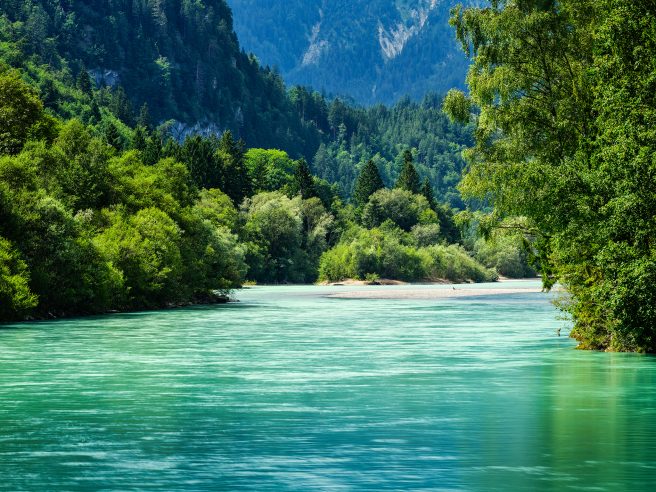
River kilometer 167 | The Füssener Lech just above the Lech Falls: just an alpine wild river, shortly afterwards a corrected and enclosed chain of dams.
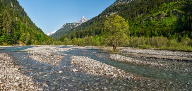
River kilometer 199 | At Vorderhornbach, after approx. 17 km, the Hornbach flows from the Allgäu Alps into the Tyrolean Lech. The wild alpine stream has its source in the mountain streams of the Hornbach chain.
On its way towards the Lech, it spreads out again and again, branching its watercourses into original gravel meadows. Like the previous side valleys with their watercourses, the Hornbach also supplies the alpine Lech with bed load and dead wood, which is needed for a variety of near-natural habitats.
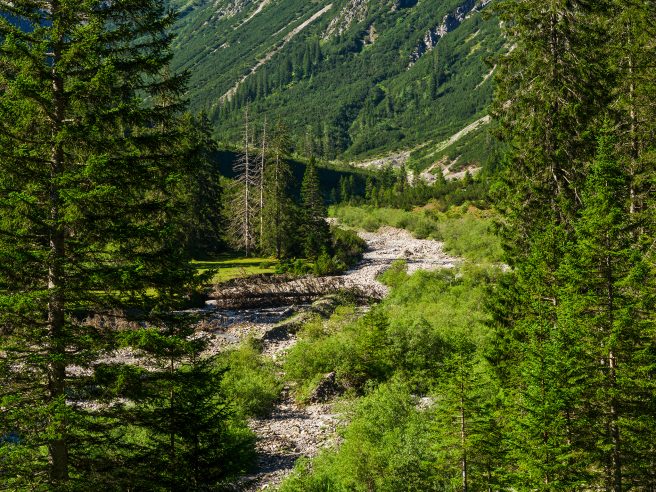
River kilometer 203 | Coming from the village of Boden through the forest above the Angerlebach stream, the valley floor (Angerleboden) opens up after a climb. The view in the morning sun over this natural gem is like discovering a long-forgotten “earthly paradise”.
Shortly after Steeg, the valley narrows more and more until the Lech finally disappears into the narrow Lech Gorge. If you follow the pass road in the direction of Warth, the rushing river can only be seen or heard sporadically. Shortly before you reach Warth, a narrow mountain road on the right leads up to Lechleiten. The detour rewards you with an impressive view over the gorge in both summer and winter. Be it down to Tyrol or up towards Lech, the winter sports capital of the Vorarlberg jet set.
From the village of Lech, you now embark on the final stage, which immerses you in an unexpected landscape. The Zuger Lechtal valley, which leads up to the Formarinsee lake, seems to have sprung from another era. Certainly a mountain landscape steeped in culture that could not be more pristine. It is therefore not surprising that Lake Formarin was voted the most beautiful place in Austria in 2015. Below the Formainalpe, you finally reach the source of the Lechur after a good 256 kilometers. If you have the time and inclination, I recommend a detour up to the Steinernes Meer. At its foot, the water collects in small rivulets, which, following the force of gravity, brings the Lech on its way...
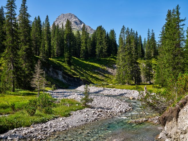
River kilometer 251 | Picturesque and romantic, the young Lech forms its riverbed with unbridled power. Here, above the Spullerbach confluence, it elicits a longing, wistful Rocky Mountains feeling from the photographer.
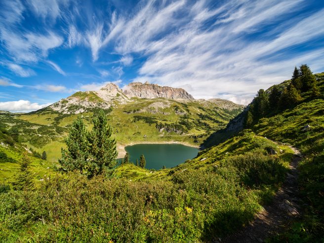
River kilometer 257 | At the end of the Zuger Tal valley, Lake Formarinsee is nestled in a basin below the striking Rote Wand. In 2015, the lake with the backdrop of the Rote Wand was voted the most beautiful place in Austria.
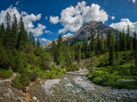
On the way along the Vorarlberger Lech in the Lechquellen Mountains between Formarinsee and the village of Lech.

